 vesseltracker.com
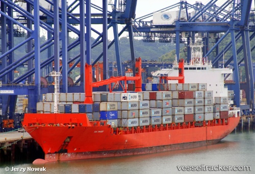
Vessel MSC ANA CAMILA III IMO: 9261827, MMSI: 636020962 Container Ship
UTC, -20.27849, 12.02652, course: 341, speed: 15.1
UTC, -20.27849, 12.02652, course: 341, speed: 15.1
2026-03-04 16:05:47 UTC, -20.27849, 12.02652, course: 341, speed: 15.1
Live Vessel MSC ANA CAMILA III Analytics (details, animations, etc.)
Live AIS position: UTC. 168 nm NW of Henties Bay (Hentiesbaai)), updated 2026-03-04 16:05:47 UTC.Find the position of the vessel MSC ANA CAMILA III on the map. The latter are known coordinates and path.
marine traffic ship tracker show on live map
The current position of vessel MSC ANA CAMILA III is -20.27849 lat / 12.02652 lng. Updated: 2026-03-04 16:05:47 UTCCurrently sailing under the flag of Liberia
MSC ANA CAMILA III built in 2003 year
Deadweight:
33716 tDetails:
Last coordinates of the vessel:
UTC, -20.85892, 12.25881, course: 340, speed: 14.7UTC, -20.27849, 12.02652, course: 341, speed: 15.1
UTC, -20.27849, 12.02652, course: 341, speed: 15.1
2026-03-04 16:05:47 UTC, -20.27849, 12.02652, course: 341, speed: 15.1