 vesseltracker.com
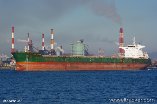
Vessel NATTY IMO: 9546904, MMSI: 636021273 Bulk Carrier
UTC, 10.31707, -14.86789, course: 194, speed: 0
UTC, 10.31656, -14.86843, course: 160, speed: 0.1
2026-03-05 09:18:50 UTC, 10.31611, -14.86927, course: -1, speed: 0
Live Vessel NATTY Analytics (details, animations, etc.)
Live AIS position: UTC. 15 nm SW of Port de Boké), updated 2026-03-05 09:18:50 UTC.Find the position of the vessel NATTY on the map. The latter are known coordinates and path.
marine traffic ship tracker show on live map
The current position of vessel NATTY is 10.31611 lat / -14.86927 lng. Updated: 2026-03-05 09:18:50 UTCCurrently sailing under the flag of Liberia
NATTY built in 2011 year
Deadweight:
176000 tDetails:
Last coordinates of the vessel:
UTC, 10.31160, -14.86638, course: -1, speed: 0.1UTC, 10.31707, -14.86789, course: 194, speed: 0
UTC, 10.31656, -14.86843, course: 160, speed: 0.1
2026-03-05 09:18:50 UTC, 10.31611, -14.86927, course: -1, speed: 0