 vesseltracker.com
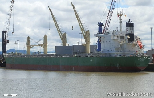
Vessel VICTORIA T IMO: 9817511, MMSI: 636022926 Cargo
UTC, 31.19449, 29.74012, course: 348, speed: 0.5
UTC, 31.19441, 29.74006, course: 346, speed: 0.2
2026-02-27 03:40:32 UTC, 31.19446, 29.74000, course: 344, speed: 0
Live AIS position:
UTC. Near EL DEKHEILA),
updated 2026-02-27 03:40:32 UTC.
Find the position of the vessel VICTORIA T on the map. The latter are known coordinates and path.
marine traffic ship tracker show on live map
The current position of vessel VICTORIA T is 31.19446 lat / 29.74000 lng. Updated: 2026-02-27 03:40:32 UTCCurrently sailing under the flag of Liberia
Details:
Last coordinates of the vessel:
UTC, 31.19470, 29.74052, course: 334, speed: 0.2UTC, 31.19449, 29.74012, course: 348, speed: 0.5
UTC, 31.19441, 29.74006, course: 346, speed: 0.2
2026-02-27 03:40:32 UTC, 31.19446, 29.74000, course: 344, speed: 0