 vesseltracker.com
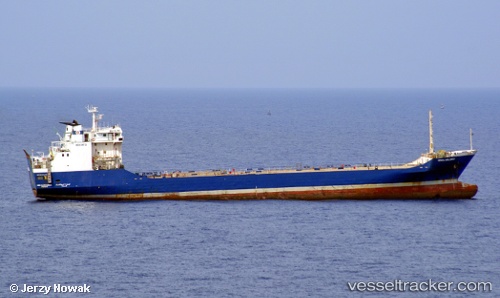
Vessel MUNEERAH IMO: 8306723, MMSI: 677083700 Cargo
UTC, 21.45134, 39.06393, course: -1, speed: 0.5
UTC, 21.45132, 39.06397, course: -1, speed: 0.3
2026-02-23 17:41:08 UTC, 21.45117, 39.06375, course: -1, speed: 0.3
Live AIS position:
UTC. Near Jeddah),
updated 2026-02-23 17:41:08 UTC.
Find the position of the vessel MUNEERAH on the map. The latter are known coordinates and path.
marine traffic ship tracker show on live map
The current position of vessel MUNEERAH is 21.45117 lat / 39.06375 lng. Updated: 2026-02-23 17:41:08 UTCCurrently sailing under the flag of Tanzania
Details:
Last coordinates of the vessel:
UTC, 21.45156, 39.06432, course: -1, speed: 1.2UTC, 21.45134, 39.06393, course: -1, speed: 0.5
UTC, 21.45132, 39.06397, course: -1, speed: 0.3
2026-02-23 17:41:08 UTC, 21.45117, 39.06375, course: -1, speed: 0.3