 vesseltracker.com
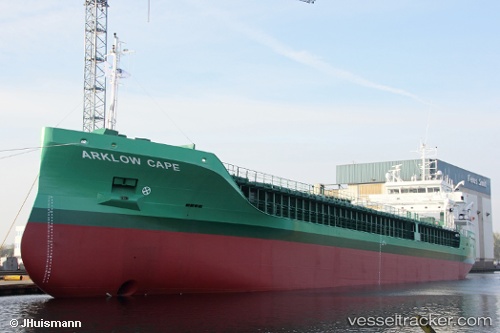
Vessel Arklow Cape IMO: 9757096, MMSI: 250004214 Multi Purpose Carrier
UTC, 57.64740, 18.86712, course: 138, speed: 3.4
UTC, 57.64872, 18.86750, course: 186, speed: 0.6
2026-01-13 12:10:05 UTC, 57.64867, 18.86732, course: 157, speed: 0.2
Live AIS position:
UTC. Near Slite),
updated 2026-01-13 12:10:05 UTC.
Find the position of the vessel Arklow Cape on the map. The latter are known coordinates and path.
marine traffic ship tracker show on live map
The current position of vessel Arklow Cape is 57.64867 lat / 18.86732 lng. Updated: 2026-01-13 12:10:05 UTCCurrently sailing under the flag of Ireland
Details:
Last coordinates of the vessel:
UTC, 57.71027, 18.80822, course: 176, speed: 0UTC, 57.64740, 18.86712, course: 138, speed: 3.4
UTC, 57.64872, 18.86750, course: 186, speed: 0.6
2026-01-13 12:10:05 UTC, 57.64867, 18.86732, course: 157, speed: 0.2