 vesseltracker.com
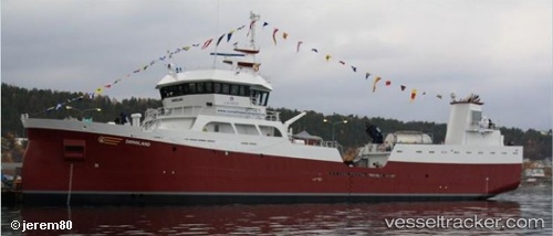
Find the position of the vessel Doennland on the map. The latter are known coordinates and path.
marine traffic ship tracker show on live map
The current position of vessel Doennland is 56.6967 lat / -2.02952 lng. Updated: 2025-02-24 08:26:51 UTCCurrently sailing under the flag of Norway
Doennland built in 2012 year
Port of registry:
Sandnessjøen (settlement in Alstahaug Municipality, Norway)Deadweight:
3000 tGross tonnage:
1536Service entry:
2012-01-01T00:00:00ZManufacturer:
Aas Mek. Verksted AS (Norwegian shipyard)Details:
Last coordinates of the vessel:
UTC, 56.4832, -2.22403, course: 24, speed: 8.4UTC, 56.6031, -2.11487, course: 24, speed: 8.3
UTC, 56.6967, -2.02952, course: 25, speed: 8.2
2025-02-24 08:26:51 UTC, 56.6967, -2.02952, course: 25, speed: 8.2