 vesseltracker.com
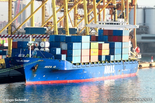
Vessel Roza A IMO: 9126742, MMSI: 271001057 Container Ship
UTC, 40.96394, 28.68051, course: 355, speed: 0
UTC, 40.96393, 28.68047, course: 355, speed: 0
2026-01-28 12:11:52 UTC, 40.96394, 28.68051, course: 355, speed: 0
Live AIS position:
UTC. Near Ambarli),
updated 2026-01-28 12:11:52 UTC.
Find the position of the vessel Roza A on the map. The latter are known coordinates and path.
marine traffic ship tracker show on live map
The current position of vessel Roza A is 40.96394 lat / 28.68051 lng. Updated: 2026-01-28 12:11:52 UTCCurrently sailing under the flag of Turkey
Roza A built in 1997 year
Deadweight:
19325 tDetails:
Last coordinates of the vessel:
UTC, 40.96394, 28.68050, course: 355, speed: 0UTC, 40.96394, 28.68051, course: 355, speed: 0
UTC, 40.96393, 28.68047, course: 355, speed: 0
2026-01-28 12:11:52 UTC, 40.96394, 28.68051, course: 355, speed: 0