 vesseltracker.com
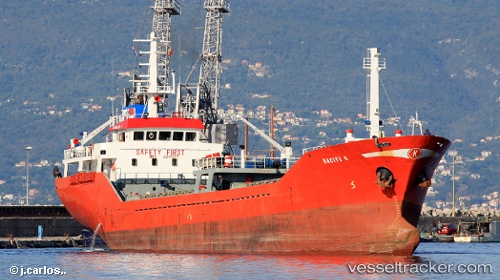
Vessel Naciye K IMO: 9217577, MMSI: 374331000 General Cargo Ship
UTC, 40.95198, 28.64433, course: 92, speed: 0.4
UTC, 40.95148, 28.64465, course: 61, speed: 0.2
2026-02-01 16:27:39 UTC, 40.95166, 28.64442, course: 43, speed: 1.4
Live AIS position:
UTC. Near Yakuplu),
updated 2026-02-01 16:27:39 UTC.
Find the position of the vessel Naciye K on the map. The latter are known coordinates and path.
marine traffic ship tracker show on live map
The current position of vessel Naciye K is 40.95166 lat / 28.64442 lng. Updated: 2026-02-01 16:27:39 UTCCurrently sailing under the flag of Panama
Naciye K built in 2000 year
Deadweight:
2340 tDetails:
Last coordinates of the vessel:
UTC, 40.91914, 28.37222, course: 79, speed: 9.5UTC, 40.95198, 28.64433, course: 92, speed: 0.4
UTC, 40.95148, 28.64465, course: 61, speed: 0.2
2026-02-01 16:27:39 UTC, 40.95166, 28.64442, course: 43, speed: 1.4