 vesseltracker.com
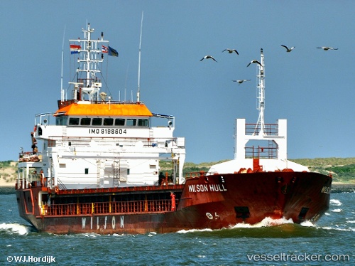
Vessel SEHER S IMO: 9198604, MMSI: 375115000 General Cargo Ship
UTC, 50.49335, -3.16783, course: 255, speed: 4.8
UTC, 50.40724, -3.30040, course: 207, speed: 3.8
2026-01-31 05:33:53 UTC, 50.29253, -3.40618, course: 214, speed: 4.4
Live AIS position:
UTC. Near River Dart),
updated 2026-01-31 05:33:53 UTC.
Find the position of the vessel SEHER S on the map. The latter are known coordinates and path.
marine traffic ship tracker show on live map
The current position of vessel SEHER S is 50.29253 lat / -3.40618 lng. Updated: 2026-01-31 05:33:53 UTCCurrently sailing under the flag of St Vincent and Grenadines
SEHER S built in 2001 year
Deadweight:
4247 tDetails:
Last coordinates of the vessel:
UTC, 50.50066, -3.03299, course: 258, speed: 4.8UTC, 50.49335, -3.16783, course: 255, speed: 4.8
UTC, 50.40724, -3.30040, course: 207, speed: 3.8
2026-01-31 05:33:53 UTC, 50.29253, -3.40618, course: 214, speed: 4.4