 vesseltracker.com
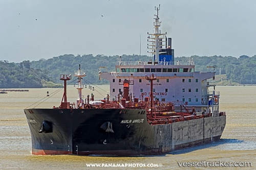
Find the position of the vessel Marlin Ammolite on the map. The latter are known coordinates and path.
marine traffic ship tracker show on live map
The current position of vessel Marlin Ammolite is 23.057 lat / -81.5456 lng. Updated: 2025-05-12 15:09:01 UTCCurrently sailing under the flag of Marshall Is
Port of registry:
Majuro (capital of the Marshall Islands)Payload_mass:
49999 tonneGross tonnage:
29534Service entry:
2016-01-01T00:00:00ZDetails:
Last coordinates of the vessel:
UTC, 23.0567, -81.5456, course: 201, speed: 0UTC, 23.0561, -81.5452, course: 235, speed: 0
UTC, 23.0568, -81.5457, course: 206, speed: 0.1
2025-05-12 15:09:01 UTC, 23.057, -81.5456, course: 202, speed: 0