 vesseltracker.com
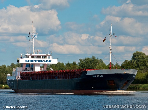
Vessel My Duru IMO: 8602000, MMSI: 577302000 General Cargo Ship
UTC, 41.27621, 19.41067, course: 127, speed: 1.1
UTC, 41.27694, 19.41121, course: 172, speed: 0.2
2026-01-28 11:52:29 UTC, 41.27680, 19.41097, course: 142, speed: 0.6
Live AIS position:
UTC. Near Durres),
updated 2026-01-28 11:52:29 UTC.
Find the position of the vessel My Duru on the map. The latter are known coordinates and path.
marine traffic ship tracker show on live map
The current position of vessel My Duru is 41.27680 lat / 19.41097 lng. Updated: 2026-01-28 11:52:29 UTCCurrently sailing under the flag of Vanuatu
My Duru built in 1986 year
Deadweight:
1506 tDetails:
Last coordinates of the vessel:
UTC, 41.31157, 19.38902, course: 350, speed: 8.8UTC, 41.27621, 19.41067, course: 127, speed: 1.1
UTC, 41.27694, 19.41121, course: 172, speed: 0.2
2026-01-28 11:52:29 UTC, 41.27680, 19.41097, course: 142, speed: 0.6