 vesseltracker.com
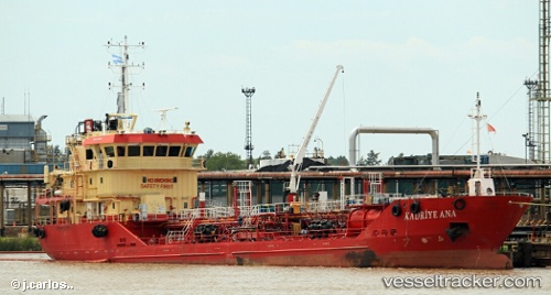
Vessel KADRIYE ANA IMO: 9449235, MMSI: 271040291 Chemical/Oil Products Tanker
UTC, 40.95922, 28.78072, course: 330, speed: 0
UTC, 40.95917, 28.78073, course: 331, speed: 0
2026-03-13 05:32:44 UTC, 40.98947, 28.95082, course: 58, speed: 0
Live Vessel KADRIYE ANA Analytics (details, animations, etc.)
Live AIS position: UTC. Near Davutpasa), updated 2026-03-13 05:32:44 UTC.Find the position of the vessel KADRIYE ANA on the map. The latter are known coordinates and path.
marine traffic ship tracker show on live map
The current position of vessel KADRIYE ANA is 40.98947 lat / 28.95082 lng. Updated: 2026-03-13 05:32:44 UTCCurrently sailing under the flag of Turkey
KADRIYE ANA built in 2010 year
Deadweight:
2412 tDetails:
Last coordinates of the vessel:
UTC, 40.95956, 28.78027, course: 333, speed: 0.1UTC, 40.95922, 28.78072, course: 330, speed: 0
UTC, 40.95917, 28.78073, course: 331, speed: 0
2026-03-13 05:32:44 UTC, 40.98947, 28.95082, course: 58, speed: 0