 vesseltracker.com
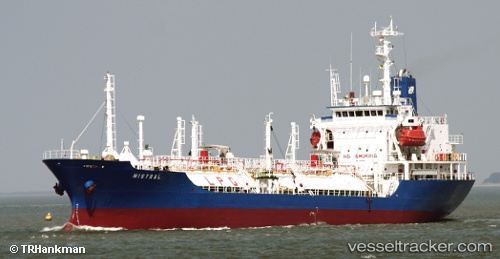
Vessel SUNDRY IMO: 9045651, MMSI: 352978176 General Cargo Ship
UTC, 40.94886, 28.87762, course: 12, speed: 0
UTC, 40.94905, 28.87711, course: 29, speed: 0
2026-02-25 18:06:27 UTC, 40.95055, 28.87714, course: 144, speed: 0.1
Live AIS position:
UTC. Near BAKIRKOY),
updated 2026-02-25 18:06:27 UTC.
Find the position of the vessel SUNDRY on the map. The latter are known coordinates and path.
marine traffic ship tracker show on live map
The current position of vessel SUNDRY is 40.95055 lat / 28.87714 lng. Updated: 2026-02-25 18:06:27 UTCCurrently sailing under the flag of Panama
SUNDRY built in 2000 year
Deadweight:
7321 tDetails:
Last coordinates of the vessel:
UTC, 40.94883, 28.87764, course: -1, speed: 0UTC, 40.94886, 28.87762, course: 12, speed: 0
UTC, 40.94905, 28.87711, course: 29, speed: 0
2026-02-25 18:06:27 UTC, 40.95055, 28.87714, course: 144, speed: 0.1