 vesseltracker.com
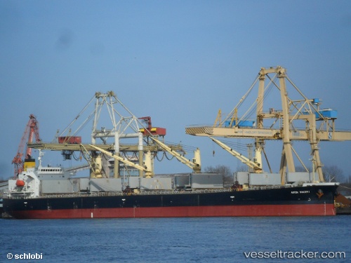
Vessel VEGA STETIND IMO: 9392729, MMSI: 538009677 Bulk Carrier
UTC, 5.75200, 81.68267, course: -1, speed: 7.5
UTC, 5.76633, 81.99800, course: -1, speed: 8.1
2026-02-25 11:54:48 UTC, 5.77887, 82.22332, course: -1, speed: 8.4
Live AIS position:
UTC. 62 nm SE of Konwelana),
updated 2026-02-25 11:54:48 UTC.
Find the position of the vessel VEGA STETIND on the map. The latter are known coordinates and path.
marine traffic ship tracker show on live map
The current position of vessel VEGA STETIND is 5.77887 lat / 82.22332 lng. Updated: 2026-02-25 11:54:48 UTCCurrently sailing under the flag of Marshall Islands
VEGA STETIND built in 2008 year
Deadweight:
55496 tDetails:
Last coordinates of the vessel:
UTC, 5.73900, 81.40750, course: -1, speed: 7.3UTC, 5.75200, 81.68267, course: -1, speed: 7.5
UTC, 5.76633, 81.99800, course: -1, speed: 8.1
2026-02-25 11:54:48 UTC, 5.77887, 82.22332, course: -1, speed: 8.4