 vesseltracker.com
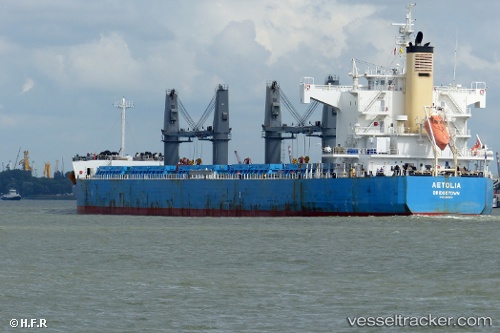
Vessel Aetolia IMO: 9425813, MMSI: 314311000 Bulk Carrier
UTC, 32.65833, -60.81833, course: -1, speed: 9
UTC, 32.79534, -60.34624, course: 68, speed: 10.4
2026-02-25 09:21:47 UTC, 32.85833, -60.13833, course: -1, speed: 10
Live AIS position:
UTC. 232 nm E of Saint George),
updated 2026-02-25 09:21:47 UTC.
Find the position of the vessel Aetolia on the map. The latter are known coordinates and path.
marine traffic ship tracker show on live map
The current position of vessel Aetolia is 32.85833 lat / -60.13833 lng. Updated: 2026-02-25 09:21:47 UTCCurrently sailing under the flag of Barbados
Aetolia built in 2010 year
Deadweight:
58106 tDetails:
Last coordinates of the vessel:
UTC, 32.51833, -61.26667, course: -1, speed: 9UTC, 32.65833, -60.81833, course: -1, speed: 9
UTC, 32.79534, -60.34624, course: 68, speed: 10.4
2026-02-25 09:21:47 UTC, 32.85833, -60.13833, course: -1, speed: 10