 vesseltracker.com
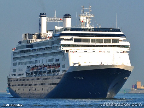
Vessel BOREALIS IMO: 9122552, MMSI: 311000987 Passenger (Cruise) Ship
UTC, -58.01587, -55.82787, course: 170, speed: 13.6
UTC, -58.52849, -55.67434, course: 171, speed: 16.6
2026-02-26 06:12:22 UTC, -58.94807, -55.55742, course: 176, speed: 13.2
Live AIS position:
UTC. 206 nm NE of Comandante Ferraz),
updated 2026-02-26 06:12:22 UTC.
Find the position of the vessel BOREALIS on the map. The latter are known coordinates and path.
marine traffic ship tracker show on live map
The current position of vessel BOREALIS is -58.94807 lat / -55.55742 lng. Updated: 2026-02-26 06:12:22 UTCCurrently sailing under the flag of Bahamas
BOREALIS built in 1997 year
Deadweight:
6351 tDetails:
Last coordinates of the vessel:
UTC, -57.48014, -55.99057, course: 174, speed: 13.3UTC, -58.01587, -55.82787, course: 170, speed: 13.6
UTC, -58.52849, -55.67434, course: 171, speed: 16.6
2026-02-26 06:12:22 UTC, -58.94807, -55.55742, course: 176, speed: 13.2