 vesseltracker.com
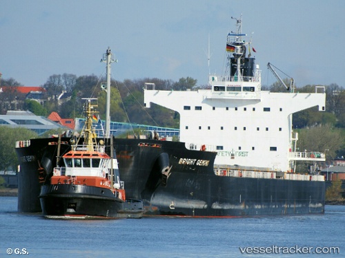
Vessel Bright Gemini IMO: 9599092, MMSI: 355959000 Bulk Carrier
UTC, 22.36321, -49.85129, course: 67, speed: 10.8
UTC, 22.47500, -49.57833, course: -1, speed: 10
2026-02-04 21:45:35 UTC, 22.64098, -49.17201, course: 66, speed: 10.5
Live AIS position:
UTC. 227 nm NW of Upper Northfield),
updated 2026-02-04 21:45:35 UTC.
Find the position of the vessel Bright Gemini on the map. The latter are known coordinates and path.
marine traffic ship tracker show on live map
The current position of vessel Bright Gemini is 22.64098 lat / -49.17201 lng. Updated: 2026-02-04 21:45:35 UTCDetails:
Last coordinates of the vessel:
UTC, 22.25179, -50.13514, course: 70, speed: 11.2UTC, 22.36321, -49.85129, course: 67, speed: 10.8
UTC, 22.47500, -49.57833, course: -1, speed: 10
2026-02-04 21:45:35 UTC, 22.64098, -49.17201, course: 66, speed: 10.5