 vesseltracker.com
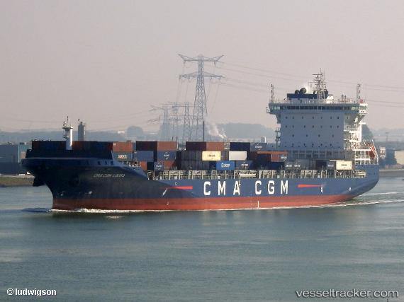
Vessel CMA CGM LOUGA IMO: 9745550, MMSI: 248655000 Container Ship
UTC, 54.67667, -34.14333, course: -1, speed: 15
UTC, 55.15833, -34.19667, course: -1, speed: 14
2026-01-31 06:30:02 UTC, 55.43667, -35.06333, course: -1, speed: 16
Live AIS position:
UTC. 273 nm NW of Swansea),
updated 2026-01-31 06:30:02 UTC.
Find the position of the vessel CMA CGM LOUGA on the map. The latter are known coordinates and path.
marine traffic ship tracker show on live map
The current position of vessel CMA CGM LOUGA is 55.43667 lat / -35.06333 lng. Updated: 2026-01-31 06:30:02 UTCCurrently sailing under the flag of Malta
CMA CGM LOUGA built in 2018 year
Deadweight:
34350 tDetails:
Last coordinates of the vessel:
UTC, 54.14816, -34.09473, course: 1, speed: 14.5UTC, 54.67667, -34.14333, course: -1, speed: 15
UTC, 55.15833, -34.19667, course: -1, speed: 14
2026-01-31 06:30:02 UTC, 55.43667, -35.06333, course: -1, speed: 16