 vesseltracker.com
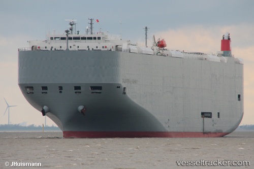
Vessel California Highway IMO: 9574078, MMSI: 352732000 Vehicles Carrier
UTC, 35.05160, 136.88074, course: 18, speed: 0
UTC, 35.05161, 136.88072, course: 18, speed: 0
2026-02-11 03:21:50 UTC, 35.05161, 136.88074, course: 18, speed: 0
Live AIS position:
UTC. Near Nagoya),
updated 2026-02-11 03:21:50 UTC.
Find the position of the vessel California Highway on the map. The latter are known coordinates and path.
marine traffic ship tracker show on live map
The current position of vessel California Highway is 35.05161 lat / 136.88074 lng. Updated: 2026-02-11 03:21:50 UTCCurrently sailing under the flag of Panama
California Highway built in 2010 year
Deadweight:
18644 tDetails:
Last coordinates of the vessel:
UTC, 35.05159, 136.88072, course: 18, speed: 0UTC, 35.05160, 136.88074, course: 18, speed: 0
UTC, 35.05161, 136.88072, course: 18, speed: 0
2026-02-11 03:21:50 UTC, 35.05161, 136.88074, course: 18, speed: 0