 vesseltracker.com
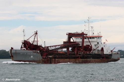
Vessel City Of Chichester IMO: 9141766, MMSI: 232003081 Hopper Dredger
UTC, 50.90440, -1.38840, course: 17, speed: 0
UTC, 50.90432, -1.38843, course: 16, speed: 0
2026-01-30 22:29:54 UTC, 50.90436, -1.38843, course: 16, speed: 0
Live AIS position:
UTC. Near Itchen),
updated 2026-01-30 22:29:54 UTC.
Find the position of the vessel City Of Chichester on the map. The latter are known coordinates and path.
marine traffic ship tracker show on live map
The current position of vessel City Of Chichester is 50.90436 lat / -1.38843 lng. Updated: 2026-01-30 22:29:54 UTCCurrently sailing under the flag of United Kingdom
City Of Chichester built in 1997 year
Deadweight:
2730 tDetails:
Last coordinates of the vessel:
UTC, 50.90435, -1.38847, course: 16, speed: 0UTC, 50.90440, -1.38840, course: 17, speed: 0
UTC, 50.90432, -1.38843, course: 16, speed: 0
2026-01-30 22:29:54 UTC, 50.90436, -1.38843, course: 16, speed: 0