 vesseltracker.com
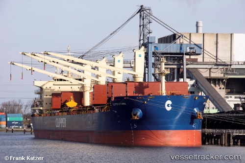
Vessel Clipper Kythira IMO: 9663116, MMSI: 538006058 Bulk Carrier
UTC, -1.18833, 107.24833, course: -1, speed: 8
UTC, -0.90167, 107.16167, course: -1, speed: 8
2026-01-29 19:29:19 UTC, -0.68667, 107.03333, course: -1, speed: 8
Live AIS position:
UTC. 100 nm NE of PANGKAL BALAM),
updated 2026-01-29 19:29:19 UTC.
Find the position of the vessel Clipper Kythira on the map. The latter are known coordinates and path.
marine traffic ship tracker show on live map
The current position of vessel Clipper Kythira is -0.68667 lat / 107.03333 lng. Updated: 2026-01-29 19:29:19 UTCDetails:
Last coordinates of the vessel:
UTC, -1.37833, 107.23833, course: -1, speed: 8UTC, -1.18833, 107.24833, course: -1, speed: 8
UTC, -0.90167, 107.16167, course: -1, speed: 8
2026-01-29 19:29:19 UTC, -0.68667, 107.03333, course: -1, speed: 8