 vesseltracker.com
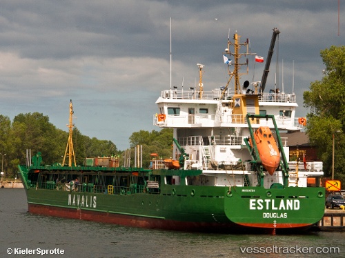
Vessel ESTLAND IMO: 9247314, MMSI: 255802660 General Cargo Ship
UTC, 60.38891, 27.15010, course: 3, speed: 7.9
UTC, 60.52396, 27.16704, course: 347, speed: 0
2026-02-11 18:01:09 UTC, 60.52396, 27.16711, course: 347, speed: 0
Live AIS position:
UTC. Near Lakulahti),
updated 2026-02-11 18:01:09 UTC.
Find the position of the vessel ESTLAND on the map. The latter are known coordinates and path.
marine traffic ship tracker show on live map
The current position of vessel ESTLAND is 60.52396 lat / 27.16711 lng. Updated: 2026-02-11 18:01:09 UTCCurrently sailing under the flag of Portugal (MAR)
ESTLAND built in 2002 year
Deadweight:
5021 tDetails:
Last coordinates of the vessel:
UTC, 60.35636, 26.97032, course: 105, speed: 9.2UTC, 60.38891, 27.15010, course: 3, speed: 7.9
UTC, 60.52396, 27.16704, course: 347, speed: 0
2026-02-11 18:01:09 UTC, 60.52396, 27.16711, course: 347, speed: 0