 vesseltracker.com
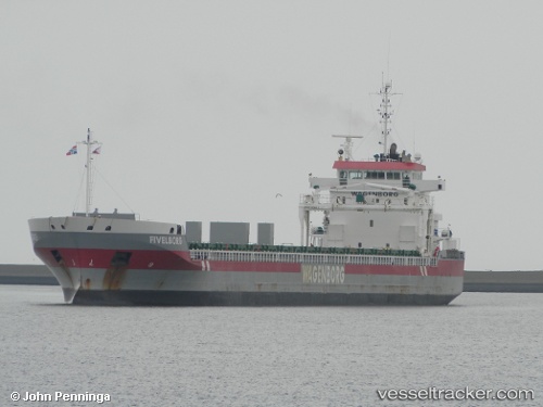
Vessel Fivelborg IMO: 9419307, MMSI: 245466000 General Cargo Ship
UTC, 58.44236, 2.03653, course: 285, speed: 11.3
UTC, 58.52167, 1.16333, course: -1, speed: 11
2026-01-27 21:58:44 UTC, 58.55894, 0.54710, course: 275, speed: 10.6
Live AIS position:
UTC. 34 nm NW of Alba Oil Field),
updated 2026-01-27 21:58:44 UTC.
Find the position of the vessel Fivelborg on the map. The latter are known coordinates and path.
marine traffic ship tracker show on live map
The current position of vessel Fivelborg is 58.55894 lat / 0.54710 lng. Updated: 2026-01-27 21:58:44 UTCCurrently sailing under the flag of Netherlands
Fivelborg built in 2010 year
Deadweight:
14603 tDetails:
Last coordinates of the vessel:
UTC, 58.37833, 2.52500, course: -1, speed: 11UTC, 58.44236, 2.03653, course: 285, speed: 11.3
UTC, 58.52167, 1.16333, course: -1, speed: 11
2026-01-27 21:58:44 UTC, 58.55894, 0.54710, course: 275, speed: 10.6