 vesseltracker.com
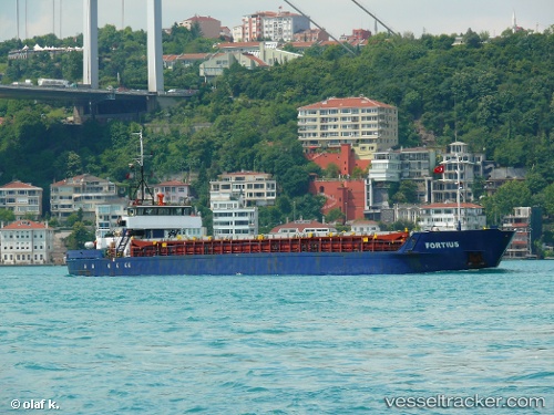
Vessel Fortius IMO: 8420701, MMSI: 577288000 General Cargo Ship
UTC, 41.26710, 29.04691, course: 50, speed: 0.2
UTC, 41.24736, 29.12677, course: 151, speed: 7.1
2026-02-09 11:28:23 UTC, 41.10666, 29.06333, course: 212, speed: 8.4
Live AIS position:
UTC. Near Istinye/Istambul),
updated 2026-02-09 11:28:23 UTC.
Find the position of the vessel Fortius on the map. The latter are known coordinates and path.
marine traffic ship tracker show on live map
The current position of vessel Fortius is 41.10666 lat / 29.06333 lng. Updated: 2026-02-09 11:28:23 UTCCurrently sailing under the flag of Vanuatu
Fortius built in 1985 year
Deadweight:
1753 tDetails:
Last coordinates of the vessel:
UTC, 41.26696, 29.04729, course: 24, speed: 0.1UTC, 41.26710, 29.04691, course: 50, speed: 0.2
UTC, 41.24736, 29.12677, course: 151, speed: 7.1
2026-02-09 11:28:23 UTC, 41.10666, 29.06333, course: 212, speed: 8.4