 vesseltracker.com
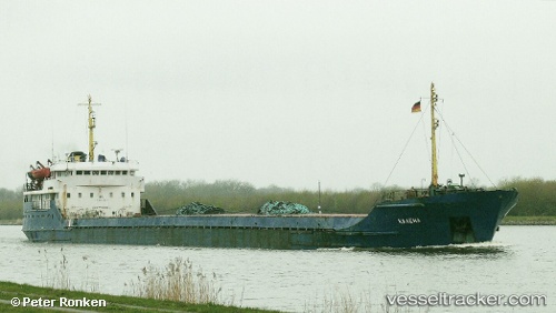
Vessel Fortuna IMO: 7729966, MMSI: 620262000 General Cargo Ship
UTC, 46.63353, 37.82030, course: 236, speed: 7.2
UTC, 46.63353, 37.82030, course: 236, speed: 7.2
2026-02-08 12:03:53 UTC, 46.63353, 37.82030, course: 236, speed: 7.2
Live AIS position:
UTC. 28 nm SE of Mariupol),
updated 2026-02-08 12:03:53 UTC.
Find the position of the vessel Fortuna on the map. The latter are known coordinates and path.
marine traffic ship tracker show on live map
The current position of vessel Fortuna is 46.63353 lat / 37.82030 lng. Updated: 2026-02-08 12:03:53 UTCCurrently sailing under the flag of Comoros
Fortuna built in 1977 year
Deadweight:
3147 tDetails:
Last coordinates of the vessel:
UTC, 46.63353, 37.82030, course: 236, speed: 7.2UTC, 46.63353, 37.82030, course: 236, speed: 7.2
UTC, 46.63353, 37.82030, course: 236, speed: 7.2
2026-02-08 12:03:53 UTC, 46.63353, 37.82030, course: 236, speed: 7.2