 vesseltracker.com
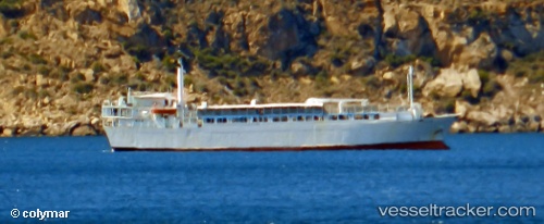
Vessel Freedom IMO: 7104972, MMSI: 450421000 Livestock Carrier
UTC, -1.50017, -48.76407, course: 270, speed: 0
UTC, -1.50167, -48.76500, course: -1, speed: 0
2026-02-06 15:26:30 UTC, -1.50333, -48.76500, course: -1, speed: 0
Live AIS position:
UTC. Near Vila do Conde Pt/Barcarena),
updated 2026-02-06 15:26:30 UTC.
Find the position of the vessel Freedom on the map. The latter are known coordinates and path.
marine traffic ship tracker show on live map
The current position of vessel Freedom is -1.50333 lat / -48.76500 lng. Updated: 2026-02-06 15:26:30 UTCCurrently sailing under the flag of Lebanon
Freedom built in 1971 year
Deadweight:
2794 tDetails:
Last coordinates of the vessel:
UTC, -1.50044, -48.76343, course: 211, speed: 0UTC, -1.50017, -48.76407, course: 270, speed: 0
UTC, -1.50167, -48.76500, course: -1, speed: 0
2026-02-06 15:26:30 UTC, -1.50333, -48.76500, course: -1, speed: 0