 vesseltracker.com
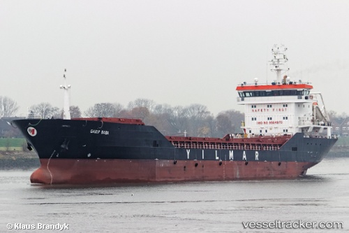
Vessel Garip Baba IMO: 9564970, MMSI: 271045646 General Cargo Ship
UTC, 41.25138, 36.44454, course: 1, speed: 0
UTC, 41.25137, 36.44458, course: 1, speed: 0.1
2026-01-28 17:37:53 UTC, 41.25137, 36.44455, course: 1, speed: 0.1
Live AIS position:
UTC. Near Samsun),
updated 2026-01-28 17:37:53 UTC.
Find the position of the vessel Garip Baba on the map. The latter are known coordinates and path.
marine traffic ship tracker show on live map
The current position of vessel Garip Baba is 41.25137 lat / 36.44455 lng. Updated: 2026-01-28 17:37:53 UTCCurrently sailing under the flag of Turkey
Garip Baba built in 2010 year
Deadweight:
8500 tDetails:
Last coordinates of the vessel:
UTC, 41.27670, 36.44214, course: 166, speed: 4.1UTC, 41.25138, 36.44454, course: 1, speed: 0
UTC, 41.25137, 36.44458, course: 1, speed: 0.1
2026-01-28 17:37:53 UTC, 41.25137, 36.44455, course: 1, speed: 0.1