 vesseltracker.com
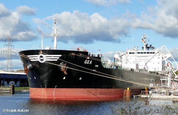
Vessel Gea IMO: 9292591, MMSI: 215924000 Chemical Oil Products Tanker
UTC, 44.7374, 37.7823, course: 315, speed: 37.3
UTC, 44.7299, 37.7752, course: 315, speed: 12.6
2026-01-29 12:15:21 UTC, 45.1697, 37.8751, course: 315, speed: 46.4
Live AIS position:
UTC. 11 nm SW of Slavyansk-Na-Kubani),
updated 2026-01-29 12:15:21 UTC.
Find the position of the vessel Gea on the map. The latter are known coordinates and path.
marine traffic ship tracker show on live map
The current position of vessel Gea is 45.1697 lat / 37.8751 lng. Updated: 2026-01-29 12:15:21 UTCCurrently sailing under the flag of Malta
Gea built in 2005 year
Deadweight:
40095 tDetails:
Last coordinates of the vessel:
UTC, 45.1682, 37.8696, course: 315, speed: 53UTC, 44.7374, 37.7823, course: 315, speed: 37.3
UTC, 44.7299, 37.7752, course: 315, speed: 12.6
2026-01-29 12:15:21 UTC, 45.1697, 37.8751, course: 315, speed: 46.4