 vesseltracker.com
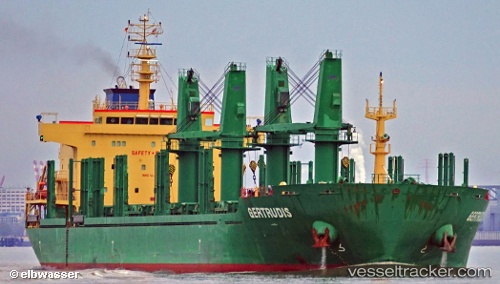
Vessel Gertrudis IMO: 9571636, MMSI: 351210000 Bulk Carrier
UTC, -25.66500, -44.22833, course: -1, speed: 11
UTC, -25.42281, -43.96713, course: 43, speed: 11.2
2026-02-10 15:50:20 UTC, -25.20347, -43.74522, course: 46, speed: 11
Live AIS position:
UTC. 53 nm W of Cidade de Angra dos Reis FPSO),
updated 2026-02-10 15:50:20 UTC.
Find the position of the vessel Gertrudis on the map. The latter are known coordinates and path.
marine traffic ship tracker show on live map
The current position of vessel Gertrudis is -25.20347 lat / -43.74522 lng. Updated: 2026-02-10 15:50:20 UTCDetails:
Last coordinates of the vessel:
UTC, -26.04333, -44.62167, course: -1, speed: 10UTC, -25.66500, -44.22833, course: -1, speed: 11
UTC, -25.42281, -43.96713, course: 43, speed: 11.2
2026-02-10 15:50:20 UTC, -25.20347, -43.74522, course: 46, speed: 11