 vesseltracker.com
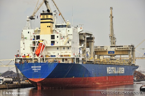
Vessel HOSANGER IMO: 9081801, MMSI: 538009774 General Cargo Ship
UTC, 32.06883, -74.43321, course: 351, speed: 9
UTC, 32.36540, -74.48680, course: 354, speed: 8.6
2026-02-09 07:06:57 UTC, 32.57037, -74.52193, course: 352, speed: 8.4
Live AIS position:
UTC. 131 nm NE of Willow Street),
updated 2026-02-09 07:06:57 UTC.
Find the position of the vessel HOSANGER on the map. The latter are known coordinates and path.
marine traffic ship tracker show on live map
The current position of vessel HOSANGER is 32.57037 lat / -74.52193 lng. Updated: 2026-02-09 07:06:57 UTCCurrently sailing under the flag of Marshall Islands
HOSANGER built in 1995 year
Deadweight:
50198 tDetails:
Last coordinates of the vessel:
UTC, 31.62604, -74.37280, course: 359, speed: 8.9UTC, 32.06883, -74.43321, course: 351, speed: 9
UTC, 32.36540, -74.48680, course: 354, speed: 8.6
2026-02-09 07:06:57 UTC, 32.57037, -74.52193, course: 352, speed: 8.4