 vesseltracker.com
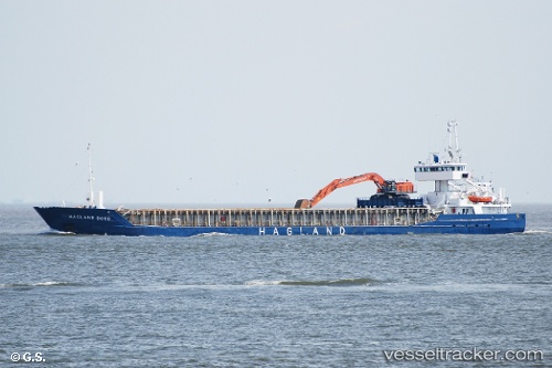
Vessel Hagland Borg IMO: 9173563, MMSI: 258709000 Multi Purpose Carrier
UTC, 59.00642, 10.93698, course: 298, speed: 10
UTC, 58.69582, 10.73960, course: 180, speed: 11
2026-02-17 20:14:55 UTC, 58.37439, 10.75073, course: 181, speed: 10
Live AIS position:
UTC. 15 nm W of SMOGEN),
updated 2026-02-17 20:14:55 UTC.
Find the position of the vessel Hagland Borg on the map. The latter are known coordinates and path.
marine traffic ship tracker show on live map
The current position of vessel Hagland Borg is 58.37439 lat / 10.75073 lng. Updated: 2026-02-17 20:14:55 UTCDetails:
Last coordinates of the vessel:
UTC, 59.10384, 11.35976, course: 318, speed: 9UTC, 59.00642, 10.93698, course: 298, speed: 10
UTC, 58.69582, 10.73960, course: 180, speed: 11
2026-02-17 20:14:55 UTC, 58.37439, 10.75073, course: 181, speed: 10