 vesseltracker.com
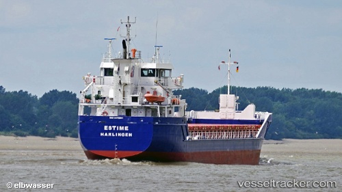
Vessel Hagland Carrier IMO: 9479931, MMSI: 257064430 General Cargo Ship
UTC, 64.45960, 11.50042, course: 146, speed: 0
UTC, 64.45961, 11.50038, course: 146, speed: 0
2026-02-17 22:14:06 UTC, 64.45961, 11.50041, course: 146, speed: 0
Live AIS position:
UTC. Near Namsos),
updated 2026-02-17 22:14:06 UTC.
Find the position of the vessel Hagland Carrier on the map. The latter are known coordinates and path.
marine traffic ship tracker show on live map
The current position of vessel Hagland Carrier is 64.45961 lat / 11.50041 lng. Updated: 2026-02-17 22:14:06 UTCCurrently sailing under the flag of Norway
Hagland Carrier built in 2011 year
Deadweight:
4450 tDetails:
Last coordinates of the vessel:
UTC, 64.45963, 11.50039, course: 147, speed: 0UTC, 64.45960, 11.50042, course: 146, speed: 0
UTC, 64.45961, 11.50038, course: 146, speed: 0
2026-02-17 22:14:06 UTC, 64.45961, 11.50041, course: 146, speed: 0