 vesseltracker.com
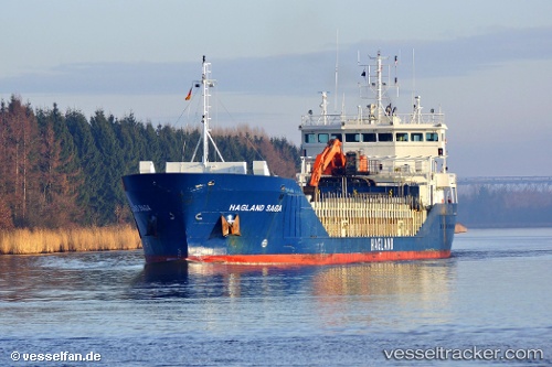
Vessel Hagland Saga IMO: 9238404, MMSI: 258809000 Multi Purpose Carrier
UTC, 57.97373, 6.78039, course: 312, speed: 13.5
UTC, 58.25970, 6.26342, course: 351, speed: 12.8
2026-02-17 18:23:41 UTC, 58.32790, 6.25720, course: 230, speed: 0.1
Live AIS position:
UTC. Near Rekefjord),
updated 2026-02-17 18:23:41 UTC.
Find the position of the vessel Hagland Saga on the map. The latter are known coordinates and path.
marine traffic ship tracker show on live map
The current position of vessel Hagland Saga is 58.32790 lat / 6.25720 lng. Updated: 2026-02-17 18:23:41 UTCCurrently sailing under the flag of Norway
Hagland Saga built in 2003 year
Deadweight:
4530 tDetails:
Last coordinates of the vessel:
UTC, 57.72623, 7.31701, course: 311, speed: 13.6UTC, 57.97373, 6.78039, course: 312, speed: 13.5
UTC, 58.25970, 6.26342, course: 351, speed: 12.8
2026-02-17 18:23:41 UTC, 58.32790, 6.25720, course: 230, speed: 0.1