 vesseltracker.com
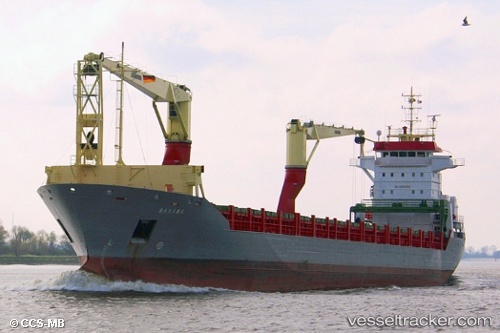
Vessel Hc Eva Marie IMO: 9369071, MMSI: 305113000 Multi Purpose Carrier
UTC, 24.84833, -16.37667, course: -1, speed: 11
UTC, 25.20526, -16.22754, course: 25, speed: 10.9
2026-01-30 05:33:45 UTC, 25.41833, -16.13333, course: -1, speed: 11
Live AIS position:
UTC. 104 nm N of Ad Dakhla),
updated 2026-01-30 05:33:45 UTC.
Find the position of the vessel Hc Eva Marie on the map. The latter are known coordinates and path.
marine traffic ship tracker show on live map
The current position of vessel Hc Eva Marie is 25.41833 lat / -16.13333 lng. Updated: 2026-01-30 05:33:45 UTCDetails:
Last coordinates of the vessel:
UTC, 24.37023, -16.54765, course: 11, speed: 11.4UTC, 24.84833, -16.37667, course: -1, speed: 11
UTC, 25.20526, -16.22754, course: 25, speed: 10.9
2026-01-30 05:33:45 UTC, 25.41833, -16.13333, course: -1, speed: 11