 vesseltracker.com
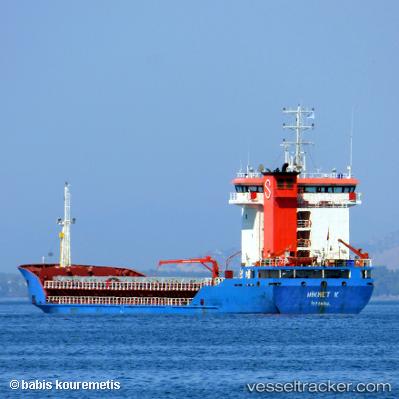
Vessel Hikmet K IMO: 9275854, MMSI: 271000724 General Cargo Ship
UTC, 42.50198, 27.54218, course: 131, speed: 0.1
UTC, 42.50075, 27.54280, course: 4, speed: 0.1
2026-02-08 10:31:15 UTC, 42.50203, 27.54223, course: 129, speed: 0.1
Live AIS position:
UTC. Near Burgas),
updated 2026-02-08 10:31:15 UTC.
Find the position of the vessel Hikmet K on the map. The latter are known coordinates and path.
marine traffic ship tracker show on live map
The current position of vessel Hikmet K is 42.50203 lat / 27.54223 lng. Updated: 2026-02-08 10:31:15 UTCCurrently sailing under the flag of Turkey
Hikmet K built in 2004 year
Deadweight:
5800 tDetails:
Last coordinates of the vessel:
UTC, 42.50093, 27.54225, course: 37, speed: 0UTC, 42.50198, 27.54218, course: 131, speed: 0.1
UTC, 42.50075, 27.54280, course: 4, speed: 0.1
2026-02-08 10:31:15 UTC, 42.50203, 27.54223, course: 129, speed: 0.1