 vesseltracker.com
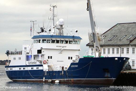
Vessel Hydrograf IMO: 8416841, MMSI: 257230500 Buoy Lighthouse Vessel
UTC, 59.60628, 5.76865, course: 324, speed: 0
UTC, 59.60628, 5.76865, course: 324, speed: 0
2026-02-08 01:28:44 UTC, 59.60628, 5.76867, course: 324, speed: 0
Live AIS position:
UTC. Near OLEN),
updated 2026-02-08 01:28:44 UTC.
Find the position of the vessel Hydrograf on the map. The latter are known coordinates and path.
marine traffic ship tracker show on live map
The current position of vessel Hydrograf is 59.60628 lat / 5.76867 lng. Updated: 2026-02-08 01:28:44 UTCCurrently sailing under the flag of Norway
Hydrograf built in 1985 year
Deadweight:
454 tDetails:
Last coordinates of the vessel:
UTC, 59.60628, 5.76865, course: 324, speed: 0UTC, 59.60628, 5.76865, course: 324, speed: 0
UTC, 59.60628, 5.76865, course: 324, speed: 0
2026-02-08 01:28:44 UTC, 59.60628, 5.76867, course: 324, speed: 0