 vesseltracker.com
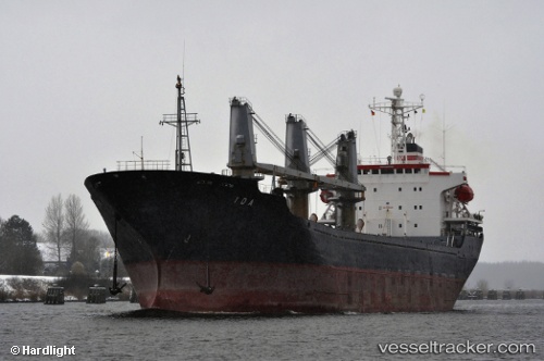
Vessel Ida IMO: 9109536, MMSI: 636016690 Bulk Carrier
UTC, 33.09667, -8.73167, course: -1, speed: 0
UTC, 33.09667, -8.73167, course: -1, speed: 0
2026-02-28 05:58:50 UTC, 33.09667, -8.73167, course: -1, speed: 0
Live AIS position:
UTC. Near Jorf Lasfar),
updated 2026-02-28 05:58:50 UTC.
Find the position of the vessel Ida on the map. The latter are known coordinates and path.
marine traffic ship tracker show on live map
The current position of vessel Ida is 33.09667 lat / -8.73167 lng. Updated: 2026-02-28 05:58:50 UTCCurrently sailing under the flag of Liberia
Ida built in 1995 year
Deadweight:
18172 tDetails:
Last coordinates of the vessel:
UTC, 33.09667, -8.73167, course: -1, speed: 0UTC, 33.09667, -8.73167, course: -1, speed: 0
UTC, 33.09667, -8.73167, course: -1, speed: 0
2026-02-28 05:58:50 UTC, 33.09667, -8.73167, course: -1, speed: 0