 vesseltracker.com
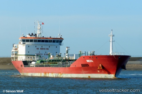
Vessel Imera IMO: 9458066, MMSI: 229561000 Chemical Oil Products Tanker
UTC, 40.76801, 29.54059, course: 37, speed: 0
UTC, 40.76801, 29.54062, course: 37, speed: 0
2026-02-26 20:22:01 UTC, 40.76624, 29.54219, course: 131, speed: 4.1
Live AIS position:
UTC. Near Diliskelesi),
updated 2026-02-26 20:22:01 UTC.
Find the position of the vessel Imera on the map. The latter are known coordinates and path.
marine traffic ship tracker show on live map
The current position of vessel Imera is 40.76624 lat / 29.54219 lng. Updated: 2026-02-26 20:22:01 UTCCurrently sailing under the flag of Malta
Imera built in 2011 year
Deadweight:
14391 tDetails:
Last coordinates of the vessel:
UTC, 40.76801, 29.54061, course: 37, speed: 0UTC, 40.76801, 29.54059, course: 37, speed: 0
UTC, 40.76801, 29.54062, course: 37, speed: 0
2026-02-26 20:22:01 UTC, 40.76624, 29.54219, course: 131, speed: 4.1