 Interlink Utility
Current Status
Where is the vessel?
Interlink Utility is currently in 61 nm E of Tavares, based on AIS data received about 14h ago.
Latest AIS update:
Current position: 31.42442° S, 49.85960° W (61 nm E of Tavares)
Average speed (last 7 days): Loading…
Average speed (last 30 days): Loading…
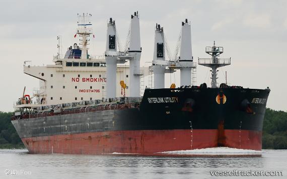
Vessel profile: Interlink Utility is a Bulk Carrier with dimensions 180m x 32m.
This page combines live AIS, route history, probable destination signals, nearby traffic, and port activity for practical vessel monitoring.
The current position of vessel Interlink Utility is -31.42442 lat / -49.85960 lng. Updated: 2026-05-23 10:23:04 UTCNearest reference points:
- 24 nm SE of São José do Norte
- Near Rio Grande
Currently sailing under the flag of Marshall Is ![]()
Details:
Live Vessel Interlink Utility Analytics (details, animations, etc.)
Recent AIS points (UTC):
2026-05-23 07:06:25 UTC · -30.97132, -49.37877 · SOG 11.3 kn · COG 222°2026-05-23 08:10:17 UTC · -31.12667, -49.53167 · SOG 11 kn · COG -1°
2026-05-23 09:43:16 UTC · -31.33333, -49.76333 · SOG 11 kn · COG -1°
2026-05-23 10:23:04 UTC · -31.42442, -49.85960 · SOG 10.7 kn · COG 223°