 vesseltracker.com
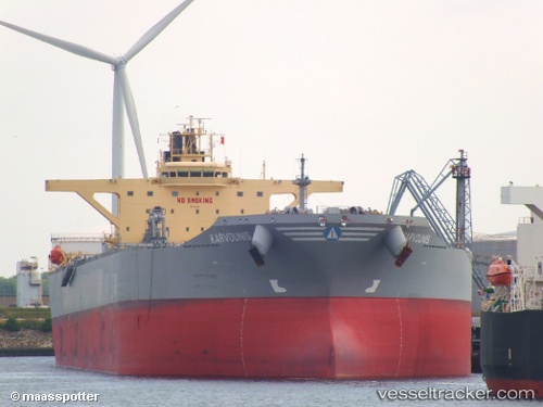
Vessel KARVOUNIS IMO: 9612052, MMSI: 636024030 Crude Oil Tanker
UTC, 39.09126, 9.08563, course: 252, speed: 0
UTC, 39.09235, 9.08476, course: 223, speed: 0
2026-02-08 19:30:47 UTC, 39.09278, 9.08388, course: 206, speed: 0
Live AIS position:
UTC. Near SARROCH),
updated 2026-02-08 19:30:47 UTC.
Find the position of the vessel KARVOUNIS on the map. The latter are known coordinates and path.
marine traffic ship tracker show on live map
The current position of vessel KARVOUNIS is 39.09278 lat / 9.08388 lng. Updated: 2026-02-08 19:30:47 UTCCurrently sailing under the flag of Liberia
KARVOUNIS built in 2013 year
Deadweight:
156229 tDetails:
Last coordinates of the vessel:
UTC, 39.09286, 9.08407, course: 210, speed: 0UTC, 39.09126, 9.08563, course: 252, speed: 0
UTC, 39.09235, 9.08476, course: 223, speed: 0
2026-02-08 19:30:47 UTC, 39.09278, 9.08388, course: 206, speed: 0