 vesseltracker.com
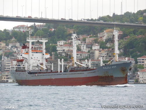
Vessel Kaleli Ana IMO: 7429322, MMSI: 616886000 General Cargo Ship
Live AIS position:
UTC. Near Tuzla Free Zone),
updated 2025-06-24 09:11:41 UTC.
Find the position of the vessel Kaleli Ana on the map. The latter are known coordinates and path.
marine traffic ship tracker show on live map
The current position of vessel Kaleli Ana is 40.82329 lat / 29.30051 lng. Updated: 2025-06-24 09:11:41 UTCCurrently sailing under the flag of Comoros
Kaleli Ana built in 1976 year
Deadweight:
6302 tDetails:
Last coordinates of the vessel:
2025-06-24 09:11:41 UTC, 40.82329, 29.30051, course: -1, speed: 0