 vesseltracker.com
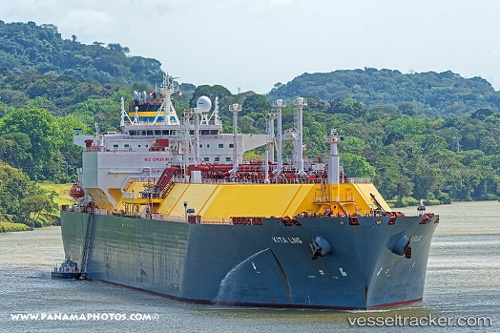
Vessel Kita Lng IMO: 9636723, MMSI: 229581000 Lng Tanker
UTC, 18.56857, 63.82382, course: 315, speed: 16.6
UTC, 19.04041, 63.37634, course: 317, speed: 16.9
2026-03-17 01:35:37 UTC, 19.32820, 63.09829, course: 317, speed: 16.5
Live Vessel Kita Lng Analytics (details, animations, etc.)
Live AIS position: UTC. 250 nm E of Masirah), updated 2026-03-17 01:35:37 UTC.Find the position of the vessel Kita Lng on the map. The latter are known coordinates and path.
marine traffic ship tracker show on live map
The current position of vessel Kita Lng is 19.32820 lat / 63.09829 lng. Updated: 2026-03-17 01:35:37 UTCCurrently sailing under the flag of Malta
Details:
Last coordinates of the vessel:
UTC, 18.10264, 64.28104, course: 316, speed: 16.9UTC, 18.56857, 63.82382, course: 315, speed: 16.6
UTC, 19.04041, 63.37634, course: 317, speed: 16.9
2026-03-17 01:35:37 UTC, 19.32820, 63.09829, course: 317, speed: 16.5