 vesseltracker.com
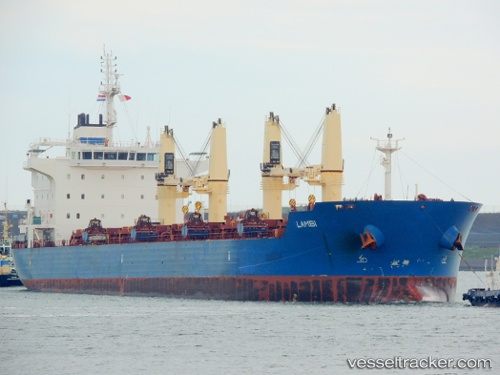
Vessel LAMBI IMO: 9595254, MMSI: 538008769 Bulk Carrier
UTC, 26.54802, -88.08678, course: 327, speed: 5.1
UTC, 26.70672, -88.21805, course: 329, speed: 4.1
2026-02-22 23:49:35 UTC, 26.83048, -88.28723, course: 331, speed: 6
Live AIS position:
UTC. 138 nm S of Port Eads),
updated 2026-02-22 23:49:35 UTC.
Find the position of the vessel LAMBI on the map. The latter are known coordinates and path.
marine traffic ship tracker show on live map
The current position of vessel LAMBI is 26.83048 lat / -88.28723 lng. Updated: 2026-02-22 23:49:35 UTCCurrently sailing under the flag of Marshall Islands
LAMBI built in 2012 year
Deadweight:
35048 tDetails:
Last coordinates of the vessel:
UTC, 26.47936, -88.01569, course: 322, speed: 5UTC, 26.54802, -88.08678, course: 327, speed: 5.1
UTC, 26.70672, -88.21805, course: 329, speed: 4.1
2026-02-22 23:49:35 UTC, 26.83048, -88.28723, course: 331, speed: 6