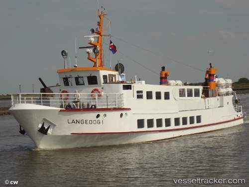
vessel Langeoog1 IMO: 7939705, Passenger Ship
Vessel Langeoog1 IMO: 7939705, Passenger Ship
MMSI: 211226480 callsign: DCBJ size: 6x31

Find the position of the vessel Langeoog1 on the map. The latter are known coordinates and path.

marine traffic ship tracker show on live map

The current position of vessel Langeoog1 is 53.726 lat / 7.49524 lng. Updated: 2024-04-18 22:49:05 UTC
Port of registry:
Langeoog (municipality in Germany)
Gross tonnage:
190
Operator:
Schiffahrt der Inselgemeinde Langeoog (transport company in Germany)
Service entry:
1968-01-01T00:00:00Z
Named after:
Langeoog (East Frisian island)

Manufacturer:
Neue Jadewerft GmbH
Details:


Last coordinates of the vessel:
UTC, 53.726, 7.49527, course: 301, speed: 0
UTC, 53.726, 7.49525, course: 302, speed: 0
2024-04-18 22:49:05 UTC, 53.726, 7.49524, course: 300, speed: 0

Track of the vessel in the last 14 days


Most frequent ports a vessels calls at Langeoog1 (211226480):

Emden, traffic: 7
Delfzijl, traffic: 3

Link to the map:


Find another ship

Langeoog1 (211226480) last ports (portcalls and passsages)

Delfzijl | 2023-07-20 08:21:14
Emden | 2023-07-17 06:32:22
Emden | 2023-07-13 06:18:09
Emden | 2023-07-09 06:12:01
Emden | 2023-07-05 05:17:34
Emden | 2023-05-10 08:23:05
Emden | 2023-05-02 12:53:00
Delfzijl | 2023-05-02 11:30:22
Delfzijl | 2022-05-11 13:44:03
Emden | 2022-05-11 10:22:33