 vesseltracker.com
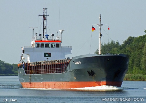
Vessel Lene D IMO: 8611013, MMSI: 305661000 Multi Purpose Carrier
UTC, 53.88957, 10.77637, course: 287, speed: 0
UTC, 53.88961, 10.77647, course: 286, speed: 0
2026-03-03 21:16:59 UTC, 53.88962, 10.77643, course: 286, speed: 0
Live AIS position:
UTC. Near Sereetz),
updated 2026-03-03 21:16:59 UTC.
Find the position of the vessel Lene D on the map. The latter are known coordinates and path.
marine traffic ship tracker show on live map
The current position of vessel Lene D is 53.88962 lat / 10.77643 lng. Updated: 2026-03-03 21:16:59 UTCCurrently sailing under the flag of Antigua Barbuda
Lene D built in 1987 year
Deadweight:
1900 tDetails:
Last coordinates of the vessel:
UTC, 53.88963, 10.77639, course: 287, speed: 0UTC, 53.88957, 10.77637, course: 287, speed: 0
UTC, 53.88961, 10.77647, course: 286, speed: 0
2026-03-03 21:16:59 UTC, 53.88962, 10.77643, course: 286, speed: 0