 vesseltracker.com
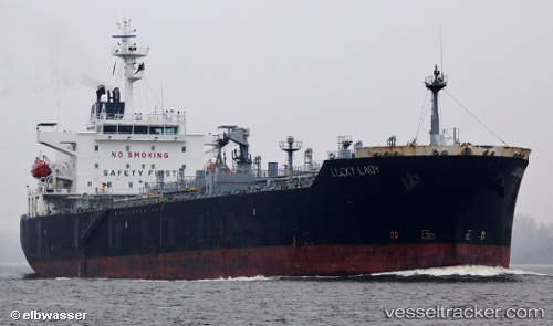
Vessel Lucky Lady IMO: 9288796, MMSI: 256901000 Chemical Oil Products Tanker
UTC, 34.38894, 33.32042, course: 342, speed: 0.4
UTC, 34.39813, 33.33514, course: 354, speed: 0.5
2026-02-24 09:55:29 UTC, 34.40572, 33.35428, course: 345, speed: 0.9
Live AIS position:
UTC. 19 nm S of Vasilikos),
updated 2026-02-24 09:55:29 UTC.
Find the position of the vessel Lucky Lady on the map. The latter are known coordinates and path.
marine traffic ship tracker show on live map
The current position of vessel Lucky Lady is 34.40572 lat / 33.35428 lng. Updated: 2026-02-24 09:55:29 UTCCurrently sailing under the flag of Malta
Lucky Lady built in 2005 year
Deadweight:
37432 tDetails:
Last coordinates of the vessel:
UTC, 34.33337, 33.38685, course: 306, speed: 5.1UTC, 34.38894, 33.32042, course: 342, speed: 0.4
UTC, 34.39813, 33.33514, course: 354, speed: 0.5
2026-02-24 09:55:29 UTC, 34.40572, 33.35428, course: 345, speed: 0.9