 vesseltracker.com
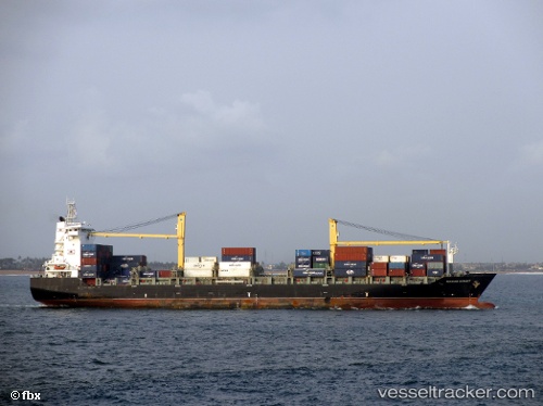
Vessel Macao Strait IMO: 9362724, MMSI: 255805611 Container Ship
UTC, 51.80311, 3.36826, course: 308, speed: 0.2
UTC, 51.80633, 3.37058, course: 227, speed: 0.2
2026-02-22 04:25:54 UTC, 51.80676, 3.37042, course: 229, speed: 0.1
Live AIS position:
UTC. Near Hunsdon),
updated 2026-02-22 04:25:54 UTC.
Find the position of the vessel Macao Strait on the map. The latter are known coordinates and path.
marine traffic ship tracker show on live map
The current position of vessel Macao Strait is 51.80676 lat / 3.37042 lng. Updated: 2026-02-22 04:25:54 UTCCurrently sailing under the flag of Portugal
Macao Strait built in 2008 year
Deadweight:
25903 tDetails:
Last coordinates of the vessel:
UTC, 51.80363, 3.36520, course: 356, speed: 0.1UTC, 51.80311, 3.36826, course: 308, speed: 0.2
UTC, 51.80633, 3.37058, course: 227, speed: 0.2
2026-02-22 04:25:54 UTC, 51.80676, 3.37042, course: 229, speed: 0.1