 vesseltracker.com
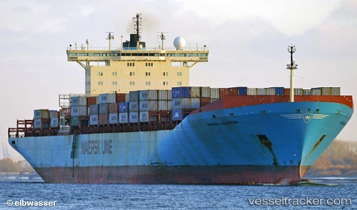
Vessel Maersk Karlskrona IMO: 9085558, MMSI: 636018800 Container Ship
UTC, -32.83014, 28.68375, course: 55, speed: 14.2
UTC, -32.52383, 29.21030, course: 45, speed: 14.8
2026-02-21 03:45:59 UTC, -32.31706, 29.40784, course: 45, speed: 15
Live AIS position:
UTC. 42 nm S of Port Saint John's),
updated 2026-02-21 03:45:59 UTC.
Find the position of the vessel Maersk Karlskrona on the map. The latter are known coordinates and path.
marine traffic ship tracker show on live map
The current position of vessel Maersk Karlskrona is -32.31706 lat / 29.40784 lng. Updated: 2026-02-21 03:45:59 UTCCurrently sailing under the flag of Liberia
Maersk Karlskrona built in 1996 year
Deadweight:
84900 tDetails:
Last coordinates of the vessel:
UTC, -33.20812, 28.07891, course: 60, speed: 13.4UTC, -32.83014, 28.68375, course: 55, speed: 14.2
UTC, -32.52383, 29.21030, course: 45, speed: 14.8
2026-02-21 03:45:59 UTC, -32.31706, 29.40784, course: 45, speed: 15