 vesseltracker.com
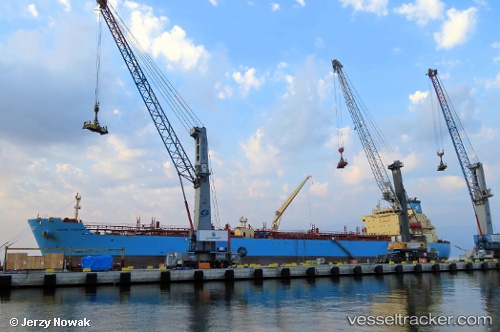
Vessel Maersk Teesport IMO: 9726463, MMSI: 219190000 Chemical Oil Products Tanker
UTC, 26.92836, -117.06446, course: 130, speed: 11.9
UTC, 26.55652, -116.57019, course: 128, speed: 12.3
2026-02-21 07:43:57 UTC, 26.43140, -116.39822, course: 128, speed: 11.9
Live AIS position:
UTC. 117 nm SW of Morro Redondo),
updated 2026-02-21 07:43:57 UTC.
Find the position of the vessel Maersk Teesport on the map. The latter are known coordinates and path.
marine traffic ship tracker show on live map
The current position of vessel Maersk Teesport is 26.43140 lat / -116.39822 lng. Updated: 2026-02-21 07:43:57 UTCDetails:
Last coordinates of the vessel:
UTC, 27.19066, -117.42969, course: 127, speed: 12.3UTC, 26.92836, -117.06446, course: 130, speed: 11.9
UTC, 26.55652, -116.57019, course: 128, speed: 12.3
2026-02-21 07:43:57 UTC, 26.43140, -116.39822, course: 128, speed: 11.9