 vesseltracker.com
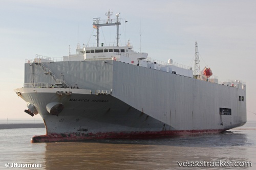
Vessel Malacca Highway IMO: 9235414, MMSI: 355351000 Vehicles Carrier
UTC, 53.34188, 7.19905, course: 270, speed: 0
UTC, 53.34189, 7.19906, course: 270, speed: 0
2026-02-23 14:08:03 UTC, 53.45897, 6.87113, course: 317, speed: 13.8
Live AIS position:
UTC. Near EEMSHAVEN),
updated 2026-02-23 14:08:03 UTC.
Find the position of the vessel Malacca Highway on the map. The latter are known coordinates and path.
marine traffic ship tracker show on live map
The current position of vessel Malacca Highway is 53.45897 lat / 6.87113 lng. Updated: 2026-02-23 14:08:03 UTCCurrently sailing under the flag of Panama
Malacca Highway built in 2001 year
Deadweight:
6864 tDetails:
Last coordinates of the vessel:
UTC, 53.34188, 7.19906, course: 269, speed: 0UTC, 53.34188, 7.19905, course: 270, speed: 0
UTC, 53.34189, 7.19906, course: 270, speed: 0
2026-02-23 14:08:03 UTC, 53.45897, 6.87113, course: 317, speed: 13.8